Map backgrounds
Product
We believe that with rich experience of our employees with data creation and processing, we can recommend you and deliver optimal map backgrounds for your systems or complete your systems with complex map solutions of appropriate quality and functionality.
Position s.r.o. is a partner of HERE (NAVTEQ), the world leading supplier of map data.
Description: Map backgrounds
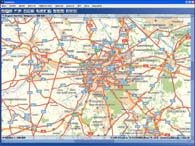
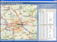
Maps for NaviGate and WMS Position services
- electronic maps for NaviGate are prepared in such a way so all the software attributes may be used;
- are stored in special *.ng format;
- *.ng format allows quick scrolling, working with huge data volumes, map zooming;
- *.ng format carries information on current data version, cartographic projection and information on copyright and other data attributes;
- special data format for NaviGate allows (besides other technical benefits) to use data for lower price than in case of data in general formats.
Raster maps
- Raster data is available also in general raster formats (GeoTIFF, TIFF, BMG, JPEG, ...).
Vector maps
- NAVTEQ vector data. Distribution and sublicensing of data in SHP format for third parties.
Description: Map backgrounds
POI - Points of interest database
- Wide offer of positional localized databases appropriate for dispatching centers and monitoring systems, but also for standard localization of objects.
SPECIALIZED PRINTED MAPS
- Customized operating atlases for utility companies.
- Atlas 1 : 100 000 for ČEZ Distribuce, atlas of distribution networks RWE – STP 1 : 50 000.
- Air map of Czech Republic in scale 1 : 200 000 for LAA ČR.
Other products
HERE (Navteq) partner
Position s.r.o. and HERE (former NAVTEQ) still from 2005 entered into a strategic partnership in the field of provision of accurate navigation data into Positions independent solutions by world leading producer of spatial data.

See maps and sample application
Sample of maps and application based on Position´s technology and services here.
Click to access the sample maps and application ...