Position Services - Cloud computing
Product
Description: Mapové podklady
WMS Position - Maps service
- Web Map Service (WMS) allows to make use of map data distributed via Internet in end-user's map and GIS applications. WMS services are standardized according to Open Geospatial Consortium, Inc. (OGC) specifications.
- WMS Position - Maps fully supports Open Geospatial Consortium standard - Web Map Service, versions 1.0.0, 1.0.7, 1.1.0, 1.1.1, 1.3.0.
- WMS Position - Maps supporting also WMTS standard (tiled maps).
- WMS Position - Maps client may be any application supporting this standard. WMS Position - Maps is fully and easily integrated in NaviGate platform as well - especially in desktop version NaviGate Enterprise.
- Safety of the service is provided by communication via secured SSL channel - THAWTE certificate. Tradition and quality of THAWTE certificates give clients full confidence into the reliability of security.
- Static maps mode for generation of static cut-outs with a possibility of displaying icons, lines and planes.
Description: Mapové podklady
Access to WMS Position - Maps service
- The access to the service is secured by username and password.
- The access is possible using standard access parameters or even more easily by incorporating the access data into URL address.
- Variant A) https://wms.position.cz/data?auser=XXXX&apass=YYYY
- Variant B) https://wms.position.cz/data/XXXX/YYYY/
Demo access and scope of data provided
- Supported coordinate systems: Mercator (EPSG:3857); UTM 33(EPSG: 32633); UTM 20 (EPSG: 32620); S-42 pás 3 (EPSG:28403); S-JTSK (EPSG: 5514/ESRI:102067)
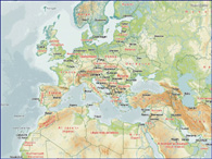
- Mercator projection containing 3 levels of Position´s overview maps of World and HERE (Navteq) Europe data in Zoom levels 7 -16 (17 locally) corresponding with most popular “standard” zoom levels scale.
- Scale range for other coordinate systems of HERE (Navteq) map data accessible in WMS Position - Maps: 1:1,000,000, 1:500,000, 1:200,000, 1:75,000, 1:25,000, 1:12,500.
- Demo access to basic DEMO layer: https://wms.position.cz/data?auser=demo&apass=demo
- Remark: For ideal quality of data displayed in GIS applications while zooming it is recommended to use the coversion 96dpi/200dpi, i.e. apply the multiplication of 0.48 x default scale range.
- DEMO layer covers only the overview Position maps of Europe
- M_EU layer covers HERE (NAVTEQ) Europe data
- M_SA layer covers HERE (NAVTEQ) South America data
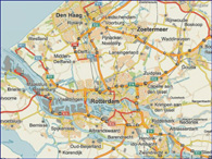
- MC_EU layer covers HERE (NAVTEQ) Europe data and 1:10,000 Czech city maps
- M_CZ layer covers HERE (NAVTEQ) CZ data
- MC_CZ layer covers HERE (NAVTEQ) CZ data and 1:10,000 Czech city maps
- M_CZ_KM layer covers HERE (NAVTEQ) CZ data with administrative borders + borders of cadastral territories
- M_DE layer covers HERE (NAVTEQ) Germany data
- M_SK layer covers HERE (NAVTEQ) SR data
- other local or customer layers..
WMS Position - Maps documentation
Platform NaviGate and WMS Position - Maps integration
- Access is secured by narrow integration of NaviGate platform via "Attached Set" and "WMS Connector" modules. With the integration the access is as simple as possible.
- NaviGate platform with Attached Set module gets access to WMS Position via the following URL address: https://wms.position.cz/set
Other products
Controls framework sample
Sample of framework Controls application T-Mobile GPS Locator
GPS Locator ...DOCUMENTATION
WMS Position - Maps